Geotrails
MacLehose Trail Geomaps

Home

Book: Hong Kong Landscapes
Book Corrections
The Workbook
Photo Album
MacLehose Trail Mapguides
MacLehose Trail Trailmaps
MacLehose Trail Geomaps
Figure illustrations
Ordering the HK Landscapes book
References to other Hong Kong books

Three types of maps are used to explain the route and features along the MacLehose Trail

Geomaps show contours and geology. They provide information on the topography crossed by the trail plus rock types and patterns of faulting that are important in landscape formation
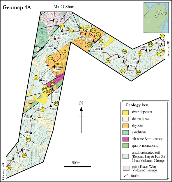
st4fig6.gif