Home
Three types of maps are used to explain the route and features along the MacLehose Trail
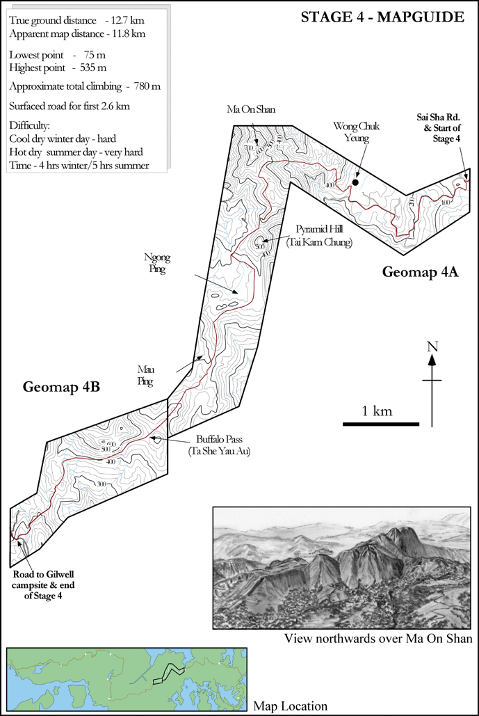
Mapguides show the general topography, Stage location, geomap locations, and introduce drawings of parts of selected parts of route